 Credit: natur&ëmwelt
Luxembourg has what is known as a Temperate Climate in which winters are generally mild and summers comparatively cool, with rainfall that can be high; its flora and fauna have thrived in and adapted to this climate over the centuries and millennia, with ongoing challenges due to pollution and recent climate change, as well as the introduction of non-native species, resulting in disruptions to the norm.
Nevertheless, with various initiatives and organisations helping the ecosystem and habitat, including sustainability and re-wilding, there is a lot happening in nature across the Grand Duchy.
Chronicle.lu has teamed up with natur&ëmwelt (the non-profit organisation (naturemwelt), the foundation (Hëllef fir d'Natur) and the Wildlife Care Centre (Flegeestatioun) for a series of articles on Luxembourg's nature reserves, in which we look at the natural habitats that preserve biodiversity and protect ecosystems from development, pollution and intensive agriculture.
No. 15 in this series focuses on Hoflee.
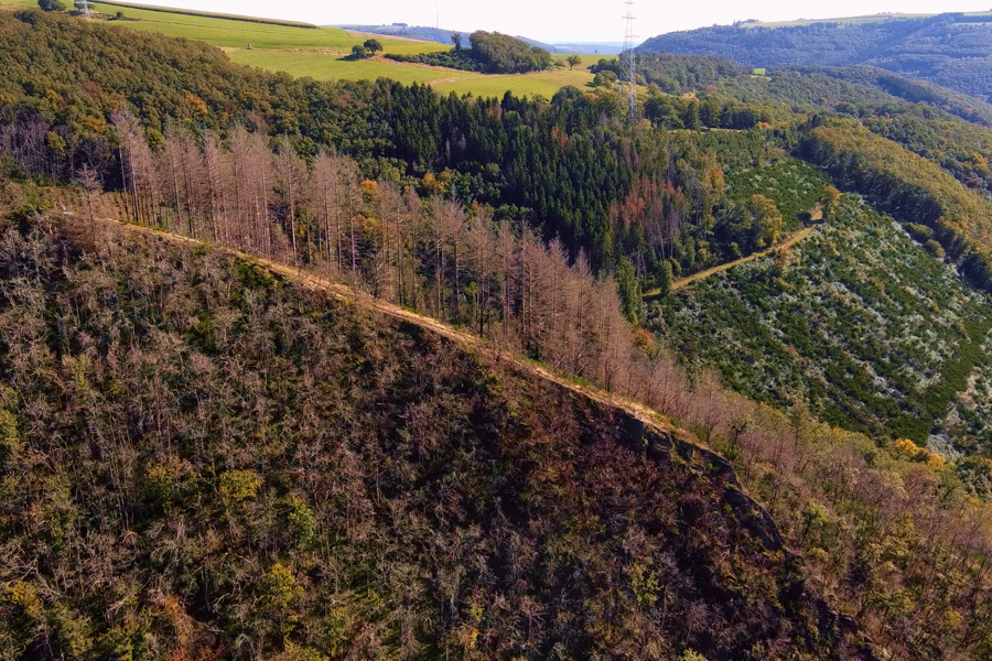
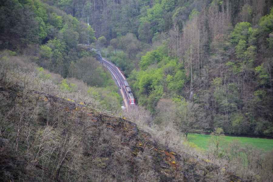
The Hoflee area, traversed by the Éislek Trail starting from Kautenbach, encompasses one of the Foundation’s most remarkable landscapes: the Wiltz valley between the Géischelterbaach ravine forest/alluvial forest and the rocky Hoflee ridge, which offers breathtaking views. At the national level, the Wiltz valley between Kautenbach and Goebelsmühle is recognised as a hotspot for slope, scree and ravine forests.
European Habitats on Extreme Slopes: Tilio-Acerion Forests
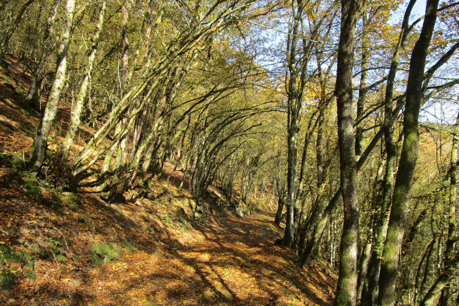
Central to this area is the Lime-Maple Forest Alliance (Tilio-Acerion), an ecosystem protected under European law. This habitat is composed of a mix of "noble" hardwoods like maple, linden (lime), ash and elm, species resilient enough to survive on steep slopes with unstable, rocky soils prone to landslides, often in cold, humid microclimates. Historically, management via coppicing meant that slope and ravine forests today frequently exhibit characteristics dominated by oak or hornbeam. This is evident in the large Géischelterbaach area, an old hornbeam coppice that still displays the mixed lime and maple characteristics typical of Tilio-Acerion, often found on sunny, south-facing slopes. Near the Hockslee viewpoint, a specific ravine forest type, Ulmo-Aceretum (elm and maple mix), persists on shaded, unstable slopes.
Flora and Fauna of the Rocky Slopes
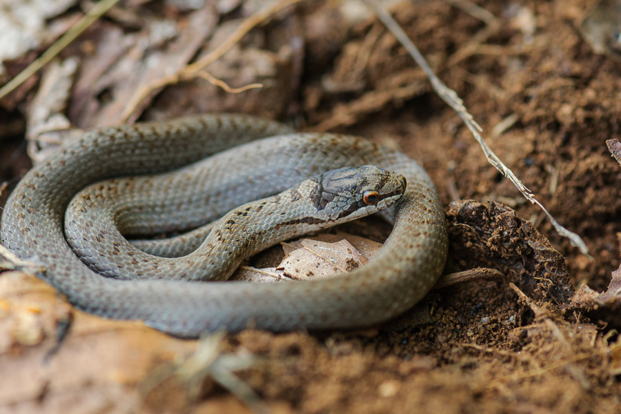
The rocky spurs of the Éislek region are known locally as Lee - prominent crests formed by erosion-resistant rock outcrops. These "Lee" act as ambassadors for a region defined by its geology and waterways. The Large-leaved Lime (Tilia platyphyllos), famously known as the village tree, served historically as a gathering or justice spot, its bark even believed to shelter powerful spirits due to its perceived healing powers. In the undergrowth, the Smooth Snake (Coronella austriaca), a harmless colubrid snake, favours the heaths, rocky fissures and forest edges; its name comes from the distinct dark patch crowning its head scales.
Resilience After Fire: Tracking Natural Regeneration
The Hoflee ridge itself holds a powerful recent memory: a major forest fire started here on 3 August 3 2018. The Foundation is closely monitoring the area devastated by the fire, which is now undergoing natural regeneration. This recovery process provides a unique, long-term study of how Ardennes forests bounce back following extreme disturbance.
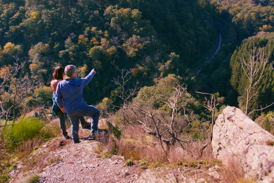
Visitor Information: Hiking the Hoflee Ridge
The Éislek Trail provides the primary access to this spectacular area, linking Kautenbach to Goebelsmühle and offering unparalleled views from the Hoflee ridge. The best time to visit is late spring or early summer to appreciate the lush, protected Lime-Maple forests and the geological features. Hikers should prepare for challenging terrain, as the slopes are steep, rocky and characterised by the underlying instability that allows these specific forest types to flourish. The trail offers exceptional vantage points, allowing views down into the Géischelterbaach valley. Visitors should be particularly mindful of the area surrounding the Hockslee viewpoint. While the fire-ravaged area is regenerating naturally, visitors must stick strictly to marked paths to avoid disturbing the sensitive recovery process and unstable ground.


