 Credit: National Inventory webpage
At the turn of the year, Chronicle.lu will present a series on ten popular and lesser-known practices passed down through generations and preserved as elements of Luxembourg’s intangible cultural heritage.
The series draws on Luxembourg’s national inventory of intangible cultural heritage, established in 2008 to document and preserve customs, crafts and community practices that contribute to the country’s cultural identity.
The list is managed by Luxembourg's Ministry of Culture with advice from the Cultural Heritage Commission (COPAC) and aligns with the UNESCO Convention for the Safeguarding of the Intangible Cultural Heritage. It includes five categories: oral traditions and expressions; performing arts; social practices, rituals and festive events; knowledge and practices concerning nature and the universe; and traditional craftsmanship.
Marking the International Day of Intangible Cultural Heritage on 17 November 2025, the Culture Ministry announced five new additions to the list, now comprising a total of 21 elements. For more on this, see https://chronicle.lu/category/culture/57416-luxembourg-adds-5-traditions-to-national-intangible-cultural-heritage-inventory.
“D’Haus- a Flouernimm”
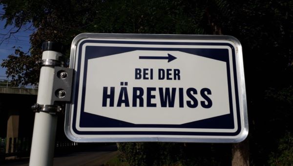
The only element on the list that falls under the category of “oral traditions and expressions” is the practice of naming local houses and fields according to the traditional interpersonal and spatial orientation system, which also comprises settlement and street names.
Added to the national inventory in July 2019, this naming practice has been passed down through generations, mainly by word of mouth, representing national identity and holding major cultural and historical importance.
In Luxembourg, the earliest known place names were given to fields, with house names appearing later and street names developing only afterwards.
Field names once referred to uninhabited areas that were not linked to any place or street name. However, population growth in recent decades, rising from 141 inhabitants per km² in 1981 to 263.7 in 2025, has come with increased land development, transferring these names to various building sites and industrial zones.
Since around 1800, street names in Luxembourg have been decided at the municipal level, where a street naming committee or the municipal administration proposes them and requests approval from the municipal council.
For most of Luxembourg’s existence, the territory was ruled by changing European powers and this history is still visible today in place names, showing Belgian, French, Dutch and German influences.
Some places in Luxembourg have kept their original names for many centuries, even since medieval times. One example is “Um Kiem”, which marks the line of an old Roman road on the Kirchberg plateau. The preserved names of local houses and fields form a living cultural heritage that shows how the Luxembourgish language has changed over time and goes back to some of the first written records from this area. In many parts of the country, these place names are older than churches.
Alongside reflecting national identity, place names also reveal elements of Luxembourg’s legal and administrative history. Examples include “Gaalgebierger” (Gallows Hill), referring to former execution sites found in every judicial district, and the field name “Bann”, which denotes a territorial district under specific legal or administrative control, as seen in Rédange-sur-Attert.
In Réiserbann (a locality in the municipality of Roeser), traditional house names such as “a Jangen”, “an Déidesch”, “a Kéifesch” and “an Hierchen” are still used. These names often derive from old family names, nicknames or the names of former owners. The name “Hierchen”, for example, comes from the historical land registry field name “Hierchesfeld” (Hierch’s field). Although the current residents have a different official surname, locals still call them “the Hierchens”.
Traditional house and field names serve not only as a practical orientation system but also reflect their role in social cohesion, sustainable development and modern spatial planning, especially when new streets, building sites, districts, industrial zones, bus routes or tram lines are created.
According to the national inventory, these traditional names are increasingly used in new place naming, and studying them can reveal archaeological or historical information before construction begins.
EO


