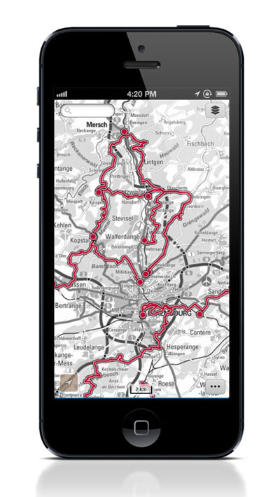
The geo-portal service of the Administration cadaster and topography (ACT) has released a map application for smartphones and other mobile devices equipped with Android and iOS operating systems. These applications allow users to display topographic maps, aerial photographs, cadastral parcels, hiking trails, and flood areas as well as many other official and interesting information on Luxembourg, the choice of more than 100 data layers (as they are also available on the general public geo-portal http://map.geoportal.lu).
The main feature, that works perfectly and very sharply, is the GPS, which one can use to locate an address, a city or local services. One can also create points of interests (POI) and explore different routes via GPS, and the Google earth application is also available for use. A big advantage is the option to download a wide choice of user maps, in order to use them later in offline mode. One of the most interesting parts of this application is the “My Maps” function, which allows users of the geo-portal to mark their own interests on the map and share them with their friends - this should be a great surprise to all geocaching enthusiasts.
A mobile web version of the application is available on http://m.geoportail.lu. It offers the same features and content that the application, except from the function of downloading data and entry points of interest. From the user's perspective, the application is very clear and easy to use, when The Luxembourg Chronicle tried it out. The search works well and the pictures and maps are very relative clear. The most surprising factor is the accuracy of the application, which is very high level. However, at some points, the application can be a little bit slow and downloading can take more time than necessary.
For hikers, walkers and cyclists, the geo-portal application would be very helpful since it includes several functions that are very useful when one is cycling a bicycle or hiking, and the traditional way of carrying loosleaf maps from the Auto Pedestre binder is not the best option. The application consists of the national hiking trails, cycle routes, bridges, cycle repairing points and cycle routes from one CFL train station to another. The application is avsailable in four languages (French, German, Luxembourgish and English) so it can be used by almost everyone in the Grand Duchy. For cycling and hiking tourists, the application also shows public transportation points on which one is allowed to bring bicycles.
Follow the links to download the application, which is free: iOS: http://g-o.lu/iOS; android: http://g-o.lu/android