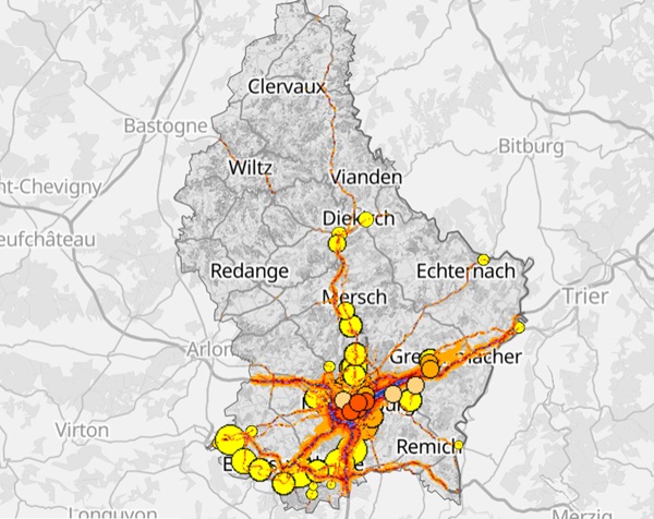
 Various noise hotspots in Luxembourg;
Credit: map.geoportail.lu
On Tuesday 12 March 2024, Luxembourg’s Environment Agency published the updated strategic noise maps, following the fourth cycle of the Environmental noise directive (END).
The maps, which are updated every five years, enable the visualisation of exposure to noise around main roads, train lines, the airport and more generally the urban areas of Luxembourg City and the agglomeration in the south.
Strategic noise maps are used to characterise the existing noise environment and to identify priority noise management areas to be remediated. This aims to develop action plans to combat ambient noise and for planning the development of municipal territory to prevent, reduce or limit the long-term effects of noise on the population.
Compared to the latest maps from 2016, new sources of noise have been added: tram noise, industrial noise and the southern agglomeration bringing together the municipalities of Käerjeng, Pétange, Differdange, Sanem, Mondercange, Esch-sur-Alzette, Schifflange, Kayl/Rumelange, Dudelange and Bettembourg.
The noise maps are calculated using specific acoustic modelling software, based on data relating to noise sources and applying the new standardised Common Noise Assessment Methods in Europe (CNOSSOS) methodology established at the European level to ensure greater uniformity.
Updated noise maps are available on the Geoportal.


