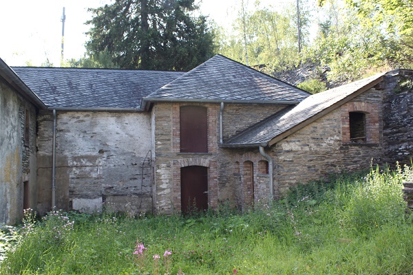
 Historical houses in Haut-Martelange;
Credit: Chronicle.lu
As part of a local history series in collaboration with local author and tour guide David Heal (Luxembourg Battles), this article looks at the local history of (Haut-)Martelange.
Based on David Heal's extensive research spanning several decades (and documented in the form of place-name index cards), the series aims to present interesting local historical events and facts linked to places in (and around) Luxembourg.
Next up: Martelange. Everyone knows this village, according to David, and in days past one had to go through it all the time. Then they opened the motorway. It is the place where the frontier with Belgium runs down the gutter. How did this come about?
In 1815, the Treaty of Vienna said that national frontiers should, wherever possible, run along ridges or rivers. When the people in Brussels laid down the frontier at Martelange, they intended that it should leave what is now the main road at the top of the hill north of Martelange (where the Chasseurs Ardennaises memorial now is) and head along a track which would have brought it down into the valley at the back of what is now Martelange in Belgium.
Unfortunately, they made a mistake, said David, and marked the frontier down into the valley and along the river. The people who marked it out on the ground did not query this and did not, as they had in Vianden, choose a frontier which would not split the village in two. They just went along the riverbank. Hence the village was split as it is today.
As fuel prices are so much lower in Luxembourg than in Belgium, filling stations were inevitably on the Luxembourg side of the road. This led to a now almost forgotten tragedy...
One day in the 1960s a fuel tanker ran away down the hill, smashed into a filling station at the bottom and exploded. A Dutch family were filling up and simply disappeared. To add to it, there was a special Mass just finishing at the Belgian Martelange church across the road, and many people who were coming out were either killed or very badly burnt. A result of this was that eventually, the relief tracks were built into the road heading north.
Apart from that, the village is or was, known for its slate industry. Despite the slate that was quarried here having been used for several centuries for house building the quality control people in the 195s refused to give certification of its durability as it has traces of oil in it, and the slate quarried elsewhere does not. There is, therefore, no standard that can be applied. Added to that the family which had owned and run the industry in Luxembourg more or less died out and when the wife of the last man to run it, died, her children were simply not interested, and they closed it all down finally. They were so uninterested that they even sold the metal window frames from the buildings, said David. The whole area is now a tourist attraction with guided tours. When they were closing down the industry the Belgians were building the Route Nationale across the Ardennes and bought an enormous slag heap of waste slate to use for the foundations.
During the Second World War, the Nazis regarded the product from here as so important for the backing for fuse boards used in everything from U-boats to tanks, the men working in the quarries (mines really), were exempt from the call-up into the German army. Until then, there had never been any form of canteen on site, but so that the men could work for longer hours the Nazis built one and it still stands there with a swastika over the door.


