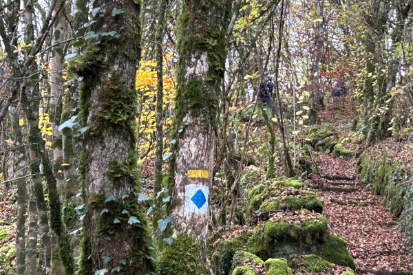
 Moersdorf auto-pédestre route;
Credit: Helen O'Mahony
Chronicle.lu has put together a short series of articles on exploring the Grand Duchy on foot, with the help of the Auto-Pédestre guide to a series of walking trails covering the five regions: this article explores Beaufort and Moersdorf walks in the Mullerthal region.
The Mullerthal region is also known as Luxembourg's Little Switzerland due to its many rock formations, ravines and woodlands that are reminiscent of the country. It is a favourite spot for hikers and walkers. The Mullerthal Trail is 112km long and is divided into three routes, which are all connected but can be hiked separately. For those who are not quite ready for that challenge, there are 24 auto-pédestre routes to choose from, ranging in distance from 5.4km (Nommern 1) to 11.8km (Altrier). My personal favourites are Consdorf-Moulin and Echternach-Gare, with its imposing rock formation known as "Wolf Gorge".
As the days get colder and darker, shorter walks seem more attractive. We chose Beaufort and Moersdorf as two short but different walks to do in the area.
The Beaufort walk is just 5.72 km long and starts at the Këppeglee car park on Route 364. It is a typically picturesque Mullerthal walk, filled with rock formations and amazing scenery.
Adding to the views at this time of year were the rich colours of the leaves, many of which were still clinging on to provide a picture-perfect backdrop to the trail.
This relatively easy walk begins with a short descent, by some stunning rock formations, to the valley of the Halerbaach river, where the panoramic vista must be seen to be believed. The walk follows the riverbank and can be crossed on stepping stones at one stage. We did need to consult the geoportal at this point, as there was a lack of blue arrow signs for guidance. The geoportal directed us to cross the river and recross further along, though we do believe that we could have stayed on the original bank without going astray. Nevertheless, this was a most scenic walk along the gurgling Halerbaach.
Having found the signage once again and breathing a sigh of relief that we had not gotten lost, the trail ascended through the forest to the Beaufort plateau. From here, there was a walk of approximately 800m on paved road to yet another wooded area which led us back to the car park.
It took us a little under two hours which included numerous stops to admire the scenery as well as consulting the geoportal. We walked during a dry period, but the ground was quite wet underfoot in places. Sturdy shoes are recommended and walking poles would be advantageous.
Moersdorf (c 7km) is described as "short but intense" and I would have to agree. We started in the car park at Moersdorf church and followed the blue diamond route in a clockwise direction, turning left on exiting the car park. A climb of approximately 170m began immediately, some of it on a narrow ledge and more on steps. This initial part of the walk is not for the faint-hearted or those afraid of heights. We were glad to have worn sturdy shoes and to have the walking poles, even if in some parts we needed to use our hands for stability.
Nevertheless, once we had that initial climb behind us, the trail became much easier as we walked through woodlands to the village of Givenich. The trail continued on paved road, passing open fields which led us through an impressive wooded area. Once again, we were glad of sturdy shoes as the path was quite rough and required all our attention, especially on the descent before returning to the starting point. We were glad to be back on "terra firma" following a tough but rewarding walk.
 Moersdorf auto-pédestre route;
Credit: Helen O'Mahony
 Moersdorf auto-pédestre route;
Credit: Helen O'Mahony


