 Credit: MEA, DATer
The Department of Spatial Planning of Luxembourg's Ministry of Energy and Spatial Planning has published the first edition of its publication "Maps and figures" (Des cartes et des chiffres), which is dedicated to land cover and land use in the Grand Duchy.
This publication explains and describes the country's land cover, land use, artificialisation and sealing. It shows that since 1999, an average of 5,000 m2 of natural soil has been artificialised per day in Luxembourg for human activities, including housing, commerce and the economy, infrastructure and green spaces. Not all artificialised spaces have been necessarily waterproofed: of the 5,000 m2 (0.5 ha) artificialised per day, on average half has been waterproofed.
For the Department of Spatial Planning, it is fundamental to understand the dynamics of current land use and thus help guide its use in the future. As such, the department has invested in a better analysis of the relevant data: by reassessing the data available since 1999 and by launching (in 2015) new higher quality regular analyses (thanks to technological advances). This approach, according to the department, responds to the desire to guarantee the objectives of an anticipatory, sustainable and resilient regional planning policy at the service of individuals and their quality of life.
Based on the scientific data collected (based in particular on high-resolution orthophotographs) and the factual analysis carried out by the Department of Spatial Planning as part of the missions of the spatial development observatory, the publication brings together a set of indicators in the form of maps, graphs and tables aimed at offering a better understanding of spatial development in Luxembourg. The department has recalled that the data relating to the soil of Luxembourg cannot be compared with those of larger countries, such as those of neighbouring countries.
For Luxembourg's Minister of Spatial Planning, Claude Turmes, "ensuring rational use of the soil is all the more important in a country with an area of 2,586 km2, where soil preservation is of major importance". He continued: "It must be managed with the utmost care because it constitutes our national heritage and our legacy for future generations. This particular attention to this resource constitutes the cornerstone of the reflections carried out during the development of the draft 2023 Master Programme in Spatial Planning, which is currently in its consultation phase".
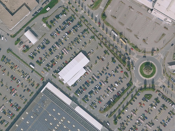
Land cover and land use
The notion of land cover refers to the physical description of space. Several biophysical categories are differentiated: vegetation areas (trees, bushes, fields, etc.), bare soils, hard surfaces (buildings, roads, etc.), wet surfaces and bodies of water. It also helps to answer questions related to the sealing of the ground, according to the Department of Spatial Planning, as well as to assess the areas occupied by buildings, other built-up areas, trees and bushes, grass, bare ground and water.
The data describing land use make it possible to visualise and extract statistics relating to the socio-economic purpose of surfaces. Minimum mapping units are less accurate than for land cover, noted the department. Artificial surfaces are classified according to their function and can encompass the size of a district. Regarding forest areas, only forests of a certain size are identified as such during land use analyses.
4.69% (12,159 ha) of the country's surface area is used for housing, meaning that more than a third of all artificial surfaces is used for residential purposes. 0.61% (1,585 ha) of the country is occupied by agricultural settlements, 1.20% by commerce and industry, 0.13% by unused urban areas and brownfields and 0.50% by social, military, cultural and other settlements. Public facilities use 0.56% of the territory, sports and leisure use 0.46% and technical infrastructure uses 0.27%.
3.73% (9,670 ha) of the surface area is dedicated to transport infrastructure, which corresponds to 29.9% of all artificial surfaces. The 0.3% of national land classified as building sites is also considered artificial. The main roads occupy 2.09% (5,410 ha) of the country, whilst the surface for rural roads corresponds to 1.16% (3,002 ha). These are not only sealed surfaces but also natural surfaces waterproofed by the vehicles circulating on them.
With regard to non-artificialised areas, 35.65% of the national area is occupied by forests and 1.86% by natural areas, which include all natural non-forested or agricultural areas. About half of the country's surface is used for agriculture (49.59%, 128,595 ha). Just under half of this area (44.68%) is made up of arable land which is plowed, just over half being grassland (52.05%) and the rest being special crops such as vineyards or orchards (3.27%).
Soil artificialisation dynamics in Luxembourg
Artificial surfaces are based on the concept and data of land use: they include built land for residential or commercial use, paved or stabilised land (roads, railways, car parks, roundabouts, etc.), and other unbuilt spaces, but which are strongly shaped by human activity (construction sites, quarries, mines, landfills, etc.). This category also includes artificialised "green" spaces (urban parks and gardens, sports and leisure facilities, etc.). The soil artificialisation dynamic is calculated by crossing two sets of data on land use for two defined periods.
For the period from 2007 to 2018, the total soil consumption is 1,865 ha, which corresponds on average to 170 ha per year, or 0.46 ha per day. For the period from 1999 to 2007, total soil consumption was 1,386 ha with an average consumption of 173 ha per year, or 0.5 ha per day.
Not all artificialised spaces are necessarily waterproofed
Impermeable surfaces are based on the concept and data of ground cover. Waterproofing refers to the permanent covering of land and its soil with an impermeable artificial material, particularly during the construction of buildings and roads. However, only part of an urbanised / artificialised area is actually waterproofed, because gardens, urban parks and other green spaces are not covered with a waterproof surface, according to the Department of Spatial Planning. Impervious surfaces form a subset of artificial surfaces.
176.5 km2 of Luxembourg soil was sealed in 2018; the national soil sealing rate is 6.8%.
"Maps and figures" publication
The series of "Maps and figures" publications aims to explain, with supporting maps and figures based on factual data, land use planning in the Grand Duchy of Luxembourg. According to the Department of Spatial Planning, territorial observation is playing an increasing role, especially since the entry into force of the new law of 17 April 2018 concerning regional planning, which provides in particular for more precise and specific missions on the rational use of land. The spatial development observatory, carried out in cooperation between the Department of Spatial Planning and the Luxembourg Institute of Socio-Economic Research (LISER), is expected to make it possible to partially fulfil this mission.


