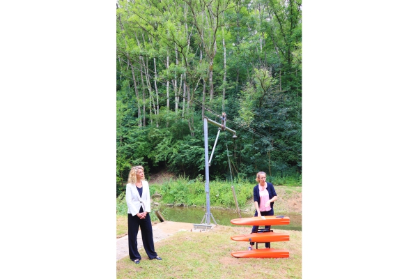
 (L-R) Joëlle Welfring, Minister for the Environment, Climate and Sustainable Development; Noémie Patz, technical expert at AGE;
Credit: MECDD
(L-R) Joëlle Welfring, Minister for the Environment, Climate and Sustainable Development; Noémie Patz, technical expert at AGE;
Credit: MECDD
During the press conference on Monday 11 July 2022, Luxembourg's Minister for the Environment, Climate and Sustainable Development, Joëlle Welfring, presented the repair, protection and prevention measures put in place and the future adaptations in the context of July 2021 floods.
“Almost a year ago, severe flooding affected most of the country. In the meantime a lot of work has been done. To name a few: waterways have been cleaned, more than 50 meetings with different stakeholders have taken place − including municipalities − with the aim of developing and adapting local protection measures, maps flood risks and the procedures in place", said Minister Welfring.
The floods that took place in July 2021 marked Luxembourg. Several measures have been initiated since then in order to improve prevention and protection in the event of floods in Luxembourg, but also information for the general public. Claude Schortgen and Noémie Patz from the Water Management Administration (l’Administration de la gestion de l’eau - AGE) gave information on the tools made available to the public, such as the draft flood risk management plan, maps of the areas flood and flood hazard and flash flood hazard maps. Mr Schortgen gave details on some of the projects initiated and Ms Patz explained the operation of a hydrometric measuring station following the example of the Hesperange station.
Key figures illustrating the efforts made in this context
- 51 public information meetings, flood, inter-administration and international partnerships held
- 27 flood risk management concepts (rain and river) and anti-flood measures projects initiated since July 2021
- Costs of planned watercourse repair measures estimated at €10.1 million
- 32 individual protection projects subsidised
- Nineteen parliamentary questions closed
Projects, studies and concepts under development
Prevention:
- Development of flood zone maps for the HQ5, HQ20 and HQ50 scenarios
- Regional warnings complementary to the level warnings
- Precautionary building measures, permits and guidelines for building in floods
- Area provision, elaboration of a national retention area cadastre
- Creation of emergency and deployment plans as part of municipal protection concepts
- Participation in the My Level app (activation planned for Luxembourg in autumn 2022)
- Commissioning of a new measuring station in Eischen
- Determination of limit values for critical rainfall
Protection:
- Renaturation of the Alzette and flood protection for the city of Luxembourg
- Flood protection concept Bollendorf-Pont; Focus on individual flood protection
- Several municipal heavy rain and flood protection concepts (Bissen, Berdorf, Bettendorf, Tandel, Junglinster, Heffingen, Wincrange, Manternach, Schengen, Bertrange, Stadtbredimus (Greiveldange), Mersch (Rollingerbach), Leudelange, Käerjeng, Differdange, Reckange-Mess, Steinfort, Rosport -Mompach, Nommern, Bettembourg, Mondorf-les-bains, Dudelange and Vianden)
- Modernisation of the valves at the flood retention basin in Welscheid
Review/Revision:
- Hydraulic study Sauer in the Steinheim section of water for the HW event of 15 July 2021
- Analysis of the event of the dates of July 2021 in collaboration with the LIST
- Review of flood protection in Echternach
- Review of flood protection Diekirch
- Hydraulic 2D recalculations and evaluations of discharge curves in the Sauer catchment area as a result of the extreme flood event in July 2021
(list is non-exhaustive)
Forecasts and warning system
Cooperation between neighbouring flood forecasting services has worked very well for a long time. The AGE forecast is based primarily on a grid model with an accuracy of 1x1 km. It takes into account short-term weather forecasts, which is very important because waterways react very quickly in Luxembourg. Other warning systems are consulted in addition to guarantee the most reliable forecast possible.
In addition, damaged hydrometric measuring stations have been repaired and duplicated in order to be more reliable.
Information in the event of a flood
The forecasts made and communicated by the AGE via the dedicated website www.floods.lu were correct. However, the news bulletin detailing the development of the situation was not visible enough. The website has been adapted to ensure that the central messages of the flood bulletin are more directly visible. In addition, an “RSS feed” is made available for the website www.floods.lu. The “Meine Pegel” mobile application will provide the population with information on the water level of the hydrometric measuring station.


