 Credit: (Source) geoportail.lu
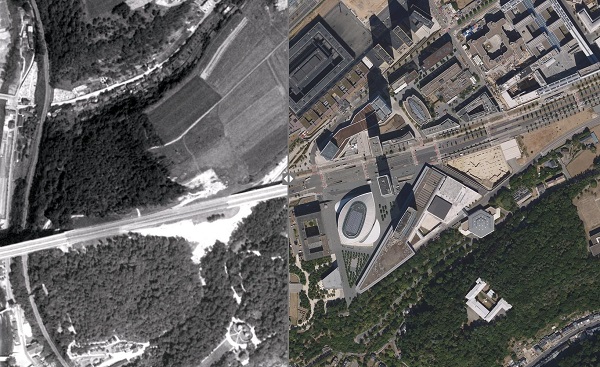
The National Roads Administration has announced that an orthophoto (aerial photograph) of Luxembourg is now available on geoportail.lu.
The Division of Surveyors and Photogrammetry (Division des géomètres et de la photogrammétrie; DGP) of the National Roads Administration has generated an orthophoto of Luxembourg in 1967, based on archived historical images.
As of Tuesday 12 March 2024, it is possible to witness the development of the country from 1967 to today, thanks to a ground resolution of 50 cm. The image was calculated based on 451 aerial shots, taken from a high altitude flight over Luxembourg. This overview of the entire country was carried out on 12 July 1967 by the company Aero Exploration GmbH on a scale of 1:40,000, as part of highway planning.
After scanning the negatives and georeferencing the images, orthorectification was carried out using the digital terrain model of the Land Registry and Topography Administration as elevation data.
The result of this work can be discovered on geoportail.lu, the national portal for providing geographic data, operated by the aforementioned administration. The orthophoto can be viewed through the link: https://g-o.lu/aero1967.


